
Discussion
A contour line joins locations having the same height above the mean sea level. The following is a contour plot of a geographical region. Contour lines are shown at 25 m intervals in this plot.
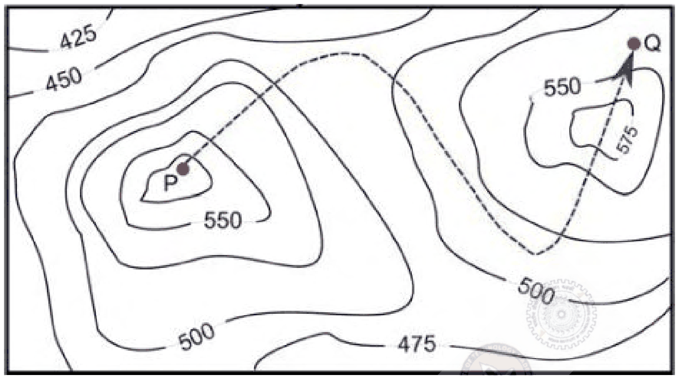
The path from P to Q is best described by
Answer: C
The path is best described as Down-Up-Down.
Read the heights from the contours, which are 25 m apart. P lies inside the innermost contour of the left-hand hill, above 550 m, so the path starts near a summit and first goes down, crossing the hill's contours outward into the lower ground between the two hills. It then climbs the right-hand hill, crossing its contours inward past 550 m and through the small 575 m closed contour at the top: up. Q lies outside that 575 m loop but inside the 550 m contour, so the last stretch drops a little from the top: down.
Options beginning 'Up' are wrong because P is already at a peak. 'Down-Up-Down-Up' adds a final climb that the path does not make, since Q is lower than the summit the path crosses.
Post your comment
Please log in or register to post a comment.
Examination Categories
- SSC Exams
- Banking Exams
- Teaching Exams
- Civil Services Exams
- Railways Exams
- Engineering Recruitment Exams
- Defence Exams
- State Government Exams
- Police Exams
- Insurance Exams
- Nursing Exams
- Other Government Exams
- NRA CET
- PG Entrance Exams
- Campus Placement
- MBA Entrance Exams
- CUET and UG Entrance
- Judiciary Exams
- Regulatory Body Exams
- Software Development